| Chilbolton to Forton |
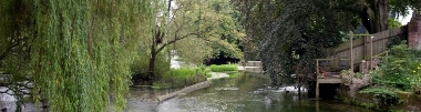
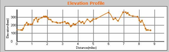
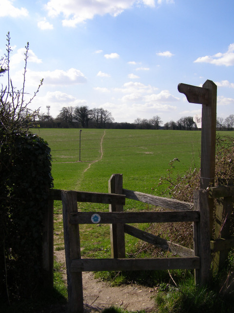
9.1 miles, circular. That's what the GPX file says ... we actually walked 10.1 according to our GPSr. It begins in the impossibly picturesque Cow Common, and the village of Wherwell. Then through Harewood, and on to Forton. It returns through the northern part of Harewood. Near Forton the Test Way has been re-routed and, for the first time in my life, I can report that the OS map really is wrong! The bit of the Test Way on the map between here and here isn't there. The route follows the road, as shown in our GPX file. It goes round the brown road to here, and the ESE along the footpath to here, and then down the yellow road to continue where it says on the map. This has meant that we have changed the next walk (Forton to St Mary Bourne) to start from here, and follow a slightly complicatewd figure-of-eight route. Park on the red circle below (Chilbolton Cow Common -- when driving through Chilbolton, look for Joy's Lane on the north side of the road), and either load the GPX file into your GPS, or follow the TW signs. Also, when you get to here the footpath going WNW isn't visible on the ground (at least, we could find no trace). Follow the track, look for paths on your left, and finally dodge through a hedge in the wood, and you'll eventually find the footpath again as it leaves the wood here. And then it crosses the main A303. And I do mean crosses. No footbridge, no tunnel. There is a "join" in the crash barrier on the central reservation, which means you can cross one carriageway in a gap in the traffic, get between the two halves of the crash barrier, and wait for the a gap in the traffic on the other carriageway. Actually, it was much easier than I feared when I first saw it. We did cross it on a sunny Sunday afternoon in August, with the dog, and easily survived to tell the tale. We were amazed by Harewood Forest. I have lived in Hampshire for 27 years, and have never been aware of it before. One interesting thing is that most of the forest tracks are concrete roadways. These seem to date from W.W2 when the forest was used to store (and hide) munitions. The day we walked through there was war happening again--Harewood has an active Paintballing scene! They didn't disturb us (or see us) and we enjoyed the ancient peace of the forest... we will return there. There are lots of other walks in the forest as OS Explorer shows (this link only works in certain browsers). I found the pig sheds slightly disturbing though ... mainly because they were so quiet! The geocaches mentioned in the bar on the right were nowhere to be seen (and apparently haven't been found for over a year). If you want more inforamtion on the area download and print out this leaflet about Longparish from Hampshire County Council. You can scroll the map below simply by moving the mouse with the left-button held down.
|
|
© Copyright Jim Champion and licensed for reuse under this Creative Commons Licence
See other pictures of this area here.
To download GPX Files, right-click the link, choose Save Link As ..., and save it to wherever you keep route files.
See the documentation that came with your GPS for information on how to download the route to your GPS.
These are a selection of Ordnance Survey Maps that cover this walk.
Geocaches on route
TBS BANK - Andover [TRAVELBUG HOTEL] (GCKCN2) (This is a multi. We couldn't find the first part, and it looks like no-one has found it for over a year)
There are caches nearby: see them on Google Maps by zomming out from the above cache.